

The Erosion of Proximity: Demographic Displacement and Spatial Social Friction in NYC
How two decades of gentrification across historic Black neighborhood anchors disrupted local social infrastructure and elevated neighborhood bias.

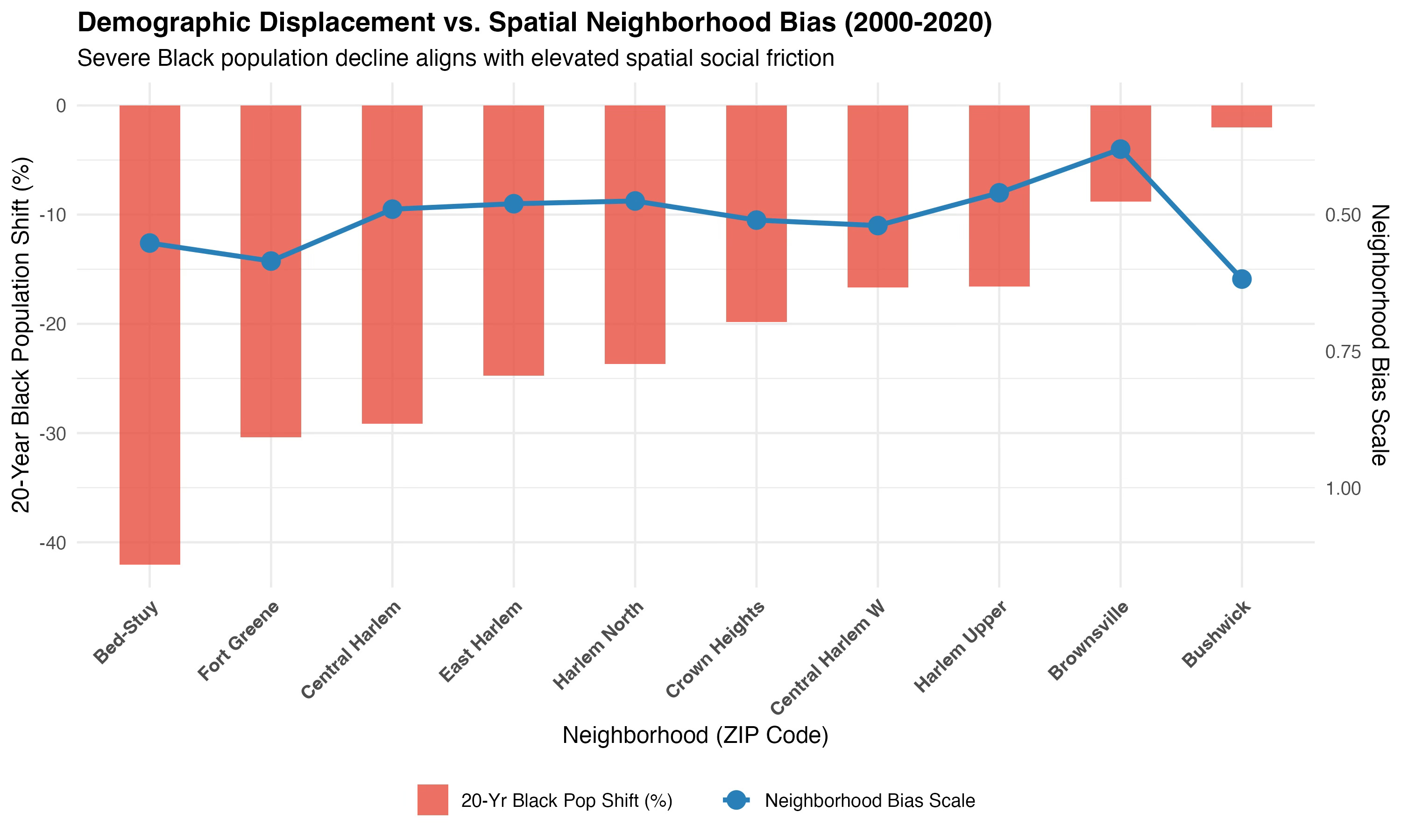
Look closely at the relationship between demographic shift and social infrastructure across Brooklyn and Upper Manhattan.
Over 20 years (2000–2020), historical Black commercial and cultural corridors experienced dramatic population displacement, led by Bed-Stuy (-42.0%), Fort Greene (-30.4%), and Central Harlem (-29.2%).
What happens to social capital when physical proximity is disrupted?
Using Opportunity Insights data, this dual-axis visualization tracks 20-year demographic shifts against Neighborhood Friending Bias—a metric measuring spatial social friction and cross-income interaction. As long-standing residents are displaced and neighborhood anchors shift, spatial social friction increases. In corridors hit hardest by displacement, physical proximity no longer guarantees cross-class social cohesion. Instead, social networks become fragmented across newly partitioned neighborhood spaces.